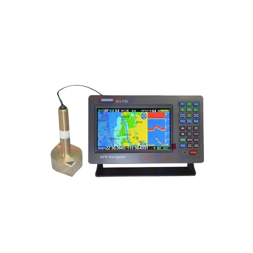
Marine GPS navigator chart fishery fish detector depth sounder multi-function three-in-one
-
Physical index
Waterproof, moisture proof, anti-fog
Appearance size 262x172x85mm
Working environment -15°C-70°C, relative
humidity below 95%Storage temperature -40°C-80°C
GPS receiving characteristics
Receiver parallel 50 channels
Accuracy less than 5 meters
Receiving frequency L1 (1575.42±MHz)
Positioning time is less than 3 seconds
(heat evoke)Tracking speed 0.1 to 1000 knots
Navigation performance
Navigation screen Positioning screen,
satellite screen, compass screen, chart screen, road screen, fishing screenDay/night mode is available, and the boat
can be used to navigate the center.The lighthouse shows a bright, steady
light. The latest chart dataAlarm mode Arrival alarm, yaw alarm, anchor
alarm, time alarm, clock alarmMemory capacity 3000 waypoints, 20 routes,
10 destinations per route3000 markers, 1 flight path
totaling 49,152 track pointsTrack features Special track protection and
can delete any trackElectrical parameters
Display TFT 7 吋 true color LCD
Power supply DC10V-DC24V
Power Maximum power consumption 4W
Fishing probe parameters
Adjust the detection accuracy method Hand /
AutoFishing frequency 200kHz
Fishing gun power 300W
Standard configuration
Power cord
2. Fixing bracket
3. Chinese manual, simple manual
4. Antenna
Reviews
There are no reviews yet.


Reviews
There are no reviews yet.